
Area
In Atlas Amazon, an area is a geographically defined space where governance, management, and stewardship practices are applied over time. Areas are the backbone of the platform: designation, governance, assessments, and indicators are all organized and linked through them.
What an Area Represents
An area is more than a mapped boundary. It is the unit that holds several dimensions of information together — a defined spatial boundary, a governance system or set of actors, a designation or form of recognition, stewardship practices and management processes, and the assessments and indicators attached to them.
That is what allows the Atlas to go beyond mapping and toward understanding how places actually function.
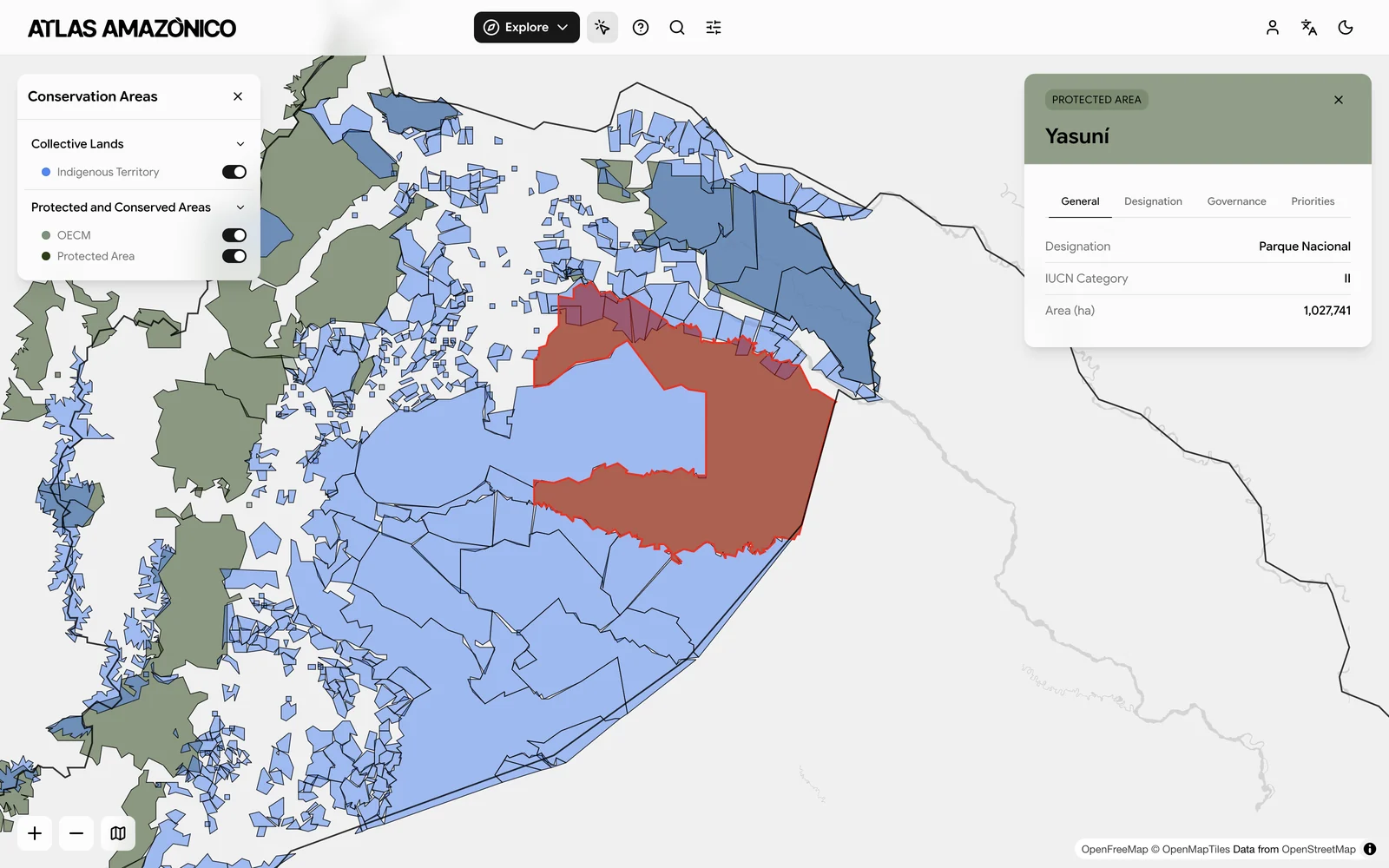 A selected area, with its boundary on the map and its metadata alongside
Types of Areas
The Atlas recognizes two broad types of area, reflecting the diversity of governance systems across the Amazon.
Protected & Conserved Areas (PCA)
Areas tied to conservation objectives through legal, policy, or institutional frameworks — national parks and reserves, regional or municipal protected areas, OECMs, and conservation instruments.
Collective Lands
Areas governed collectively by Indigenous peoples, local communities, or Afro-descendant groups, typically characterized by collective tenure or customary rights, community-based governance, and long-term social-ecological relationships.
Both types are described in detail under Area Classification.
Areas as the System Foundation
Because all data in the Atlas is organized around areas, each area doubles as a reference point. It is where designation (how the area is recognized), governance (who decides and how), stewardship (how it is managed in practice), assessments (how those systems are evaluated), and indicators (how patterns are analyzed) all converge. That convergence is what makes integration across data types — and comparison across governance systems and regions — possible.
Challenges
Defining and maintaining areas across the Amazon is not straightforward.
| Challenge | Description |
|---|---|
| Incomplete data | Many areas, particularly collective lands, are missing from global datasets |
| Dynamic boundaries | Areas change over time through designation, expansion, or governance processes |
| Overlapping systems | Multiple governance systems may exist within the same spatial extent |
| Variation across countries | Classification systems and definitions differ significantly across national contexts |
Together these require an approach that is structured enough to compare but flexible enough to be accurate.
Atlas Approach
The Atlas responds by keeping area definitions flexible enough to accommodate multiple governance systems, linking every area to standardized metadata fields, allowing areas to overlap or nest within one another, and tracking how boundaries and designation change over time. The result balances consistency against the real complexity of governance on the ground.